Þingvellir submerged: An underwater archaeological survey of Þingvallavatn
Þingvellir submerged: An underwater archaeological survey of Þingvallavatn
Kevin Martin og Jens Lindström
This presentation outlines the results of a week-long marine archaeological survey carried out in August 2023 in Þingvallavatn within the historic landscape of Þingvellir. The project was carried out in collaboration with Þingvellir National Park. It was directed by Kevin Martin together with Jens Lindström (Nordic Maritime Group), John McCarthy (Flinders University), and Jorgen Denker (JD Marine). Gunnar Grímsson (ÞNP) carried out the drone surveys. Funding for the project was provided through a grant from Forminjasjóður and Þingvellir National Park.
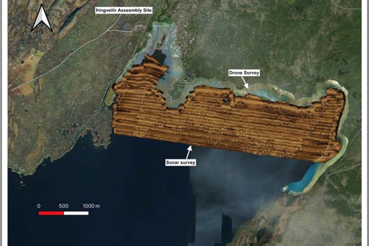
The team combined drone mapping, side-scan sonar and ROV (underwater drone) surveys to explore around 7.5 km² of the northern part of Þingvallavatn. These methods allowed the team to search for the presence of underwater archaeological features without disturbing the lakebed. A number of potential targets of cultural interest were identified and later accessed using a mix of snorkelling, diving and ROV inspections.
Particular focus was placed on surveying areas linked to historic settlement around Þingvallavatn that are believed to have become submerged over the past 300 years, including the former farm area at Vatnskot. Conducting underwater archaeological work in this lake presents unique challenges due to its history of volcanic, tectonic and seismic activity. One of the key aims of the 2023 project was therefore to test and identify the most effective survey methods for investigating cultural heritage in such a dynamic and complex environment.
Fyrirlesturinn er hluti af Nýjar rannsóknir í fornleifafræði 2026, fyrirlestraröð Félags fornleifafræðinga og námsbrautar í fornleifafræði við Háskóla Íslands. Fyrirlesturinn fer fram miðvikudaginn 4. mars kl. 12 á Zoom, hægt að fylgjast með hér: Fyrirlesturinn í streymi